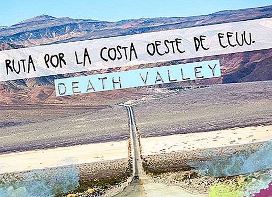
They ask us on Facebook if we are aware of the heat wave, we see it on the news and we hear it on the radio ... This area of the United States is suffering the greatest heat wave of the year, and we let's visit the hottest spot on the planet*. How interesting ... We talked about Death valley, where temperatures of more than 55 degrees are reached! Here we tell you how to plan your visit and what to see and do in Death Valley.
* The hottest place in the world? It is actually the hottest place in America, with maximum temperatures in summer of more than 50 degrees. The historical record was given in 1913 with 134 ° F (57 ° C), we touched it!
ROUTE INFORMATION
- Point: Bakersfield
- Final point: Las Vegas
- Total miles: 420
- Miles in Death Valley: 130
- Estimated time: 9 and a half hours
- Time dedicated to Death Valley: 4 hours and a half
- Death Valley price: $ 25 per car (included in the America the Beautiful pass, available at any park in the National Parks network, valid for 1 year and priced at $ 80 per car). At the entrance there are no rangers, so you will have to put the money in a box and take a paper (we do not know exactly how it works, we carried the pass).
- What to see in Death Valley:
- Mesquite Flat Sand Dunes
- Furnace Creek (Information Center)
- Devil's Golf Course
- Badwater (-86 meters)
- Artists Palette
- Golden canyon trail
- Zabriskie Point
- Dantes View
The route is made from west to east (or vice versa, depending on where you come from). We came from Yosemite the first day and Kings Canyon and Sequoia National Parks the second. We stayed to sleep in Bakersfield and it was from here that we arrived at Death Valley. We therefore made the entrance through the highway 190 from the west and we leave the Death Valley in the east towards Las Vegas on the State Line Road to Pahrump and from there the 160.
Here you just have to go with your own car and visit the sites in a little while you get out of it, the rest is to play your life face to face or cross! The main road (190) it crosses the Death Valley, although to see the most interesting places you have to deviate on other secondary roads and back and forth on it.
→ Park maps
These are some of the most important points of interest in the park:
1. Mesquite Flat Sand Dunes
After crossing the hills and entering the Death Valley, the first stop of interest are these dunes that are on our left. The car park is two steps from the beginning of the arena and is easy to reach. Just don't try to go through them because you can die trying (literally). Although tiny, they are very cool!

2. Furnace Creek (Information Center)
This point is more or less in the middle of the park. Here you have bathrooms and the tourist information point, exhibitions, a movie that explains the phenomenon of Death Valley and a thermometer at the exit where you can check the temperature at which you are. As we told you, in the heat wave and in June, we got to be 127 degrees Fahrenheit, or what is the same, 53 degrees Celsius!
The truth is that the heat is almost unbearable, but the feeling is that you could spend more time outside. It is when you get to the car and you start drinking when you start to sweat and without knowing that you already have 2 liters of water and you have just arrived! Worst of all is not the sun in your head hammering your back, it is when a blast of burning wind rises that burns your eyelids and burns your skin! God, it's the closest thing to Terminator's apocalypse we've ever lived!

3. Devil's Golf Course
The translation is "the Devil's golf course", olé! It is on the right as it goes to Badwater and is a place full of salt blocks with cool shapes. The road did not look excellent and we prefer to pass by.

4. Badwater Basin (-86 meters)
It is the lowest point of the northern hemisphere at 86 meters below sea level, if you look up, just down from the car you will see a sign on the rocks that indicates where point 0 is at sea level ... and flipas (so high? ??? !!). But you freak out more when you start walking along the salt path that goes into the valley and your feet start to cook! Which did not prevent me from running a few meters over there like a headless chicken (an illusion I had, like running through the Chinese Wall, don't judge me).
It is 27 km from the detour and the road is in perfect condition.

5. Artists Palette
On this same road returning to the main one is the loop by the Artists Palette (only in one direction), a road that runs through some small canyons and mountains with different colors depending on the oxidation and materials. Reds, greens, yellows ... an authentic artist's palette! The origin must be sought 5 million years ago when there was a tremendous volcanic explosion and minerals were scattered throughout the area. With the passage of time, heat and water were modified, with the result we see now.
From Badwater Basin the entrance to the loop is 14 km away.

6. Golden Canyon Trail
If you are visiting the Death Valley in summer it is an excellent place to die, if you do it in another cooler time it is an excellent place to walk. Its about Death Valley's most popular trail, which runs through a canyon to the impressive Red Cathedral. We only did the first part and, after burning our ears with the waves of air / fire that ran through here, we returned to the car at full speed. But we are looking forward to more!
You have the option of arriving at the Red Cathedral in 1.25 miles or taking a 4-mile loop-shaped tour.

7. Zabriskie Point
It is a spectacular viewpoint over the incredible mountains, with its rare shapes and infinite colors. The car park is next to the main road, from there there is a climb up a 5-minute paved road to the viewpoint. One of the best views of Death Valley, but not the best ... read on.

8. Dantes View
Boom! The view from this viewpoint, at 1669 meters high, especially the Death Valley is brutal! We can't say anything else ... just look at the photos. Ah, beware of the bees that have not found another better place to live, is plagued with them!
To get there you have to take a detour along a well paved road for 13 miles, the last half mile is quite steep and the road zigzags, but it is not dangerous for the car (unless you come in a Mustang of the year 50!). We came with a Ford Fiesta, 4 people plus all the luggage and held on like a bull, not only here but the whole trip.

Other visits off the main route in Death Valley (we didn't see them)
- Twnety Mule Team Canyon. It is a loop tour near Zabriskie Point.
- Ubehebe Crater. A crater of 722 meters in diameter. North of the park
- Scotty-s Castle. It is a castle built at the time of the gold rush (here they also came to try their fortune). Although apparently it is closed until 2019. It is located in the northern part.
- A ghost town to the north.
- Father Crowley Point. A place with spectacular views. To West.
- Always check the official website updates about the state of the park, access roads, weather forecasts, etc.
- Download the map of Death Valley Park to prepare your itinerary.
- At the entrance to the park there are no rangers, although if you have to pay the entrance it can be done in an honesty box. We have the annual Beautiful America pass so we don't even stop, we don't know if you can get a map and more information right there or wait until the Furnace Creek Visitor Center, where we stop.
- In the park there are two points with gas stations, in Panama Springs (it is not expensive excessively) and in Furnace Creek where the information center is (more expensive). But before arriving at the park there are quite a few miles without gas stations, so be sure to fill the tank at the beginning of the day.
- You can stop to eat at some points like in Panama Springs, where there is a shop with A / C and on the other side a restaurant (prices are not very high). We had a picnic here on a little table outside (at 49 degrees in the shade) and we were eating full milk in 10 minutes.
- Car parks with shade for the car to rest, we only saw them at the Furnace Creek information center.
- Along the park there are bathrooms, but we saw almost no water (and the one we saw was burning). It is best to buy a neverita (the median fabric costs about $ 10 at Walmart, the white cork is more expensive) and fill it with ice. Also buy bottles of water to drink and exchange in the fridge. They recommend between 3 and 4 liters of water per person, we drink about 2.5-3 liters in total per person.
- Needless to say, you put your feet in your ears with sunscreen, that you cap a cap and don't stay long outside the car.
- The entrance road to Death Valley if you come from the west is quite steep. If you see that the car heats up choose to pass your heat and remove the air conditioning (if only for the climb). This also applies to the climb to Dantes View.
- If the car overheats do not turn off the engine, open the hood (be careful not to burn) and pour water into the radiator area.
- There are some areas that are not accessible for long vehicles (also watch the climbs if you go by motorhome, they advise against climbing to the Dantes View).
- Whether you have paid this ticket or if you have the America the Beautiful pass, you will have to put the ticket (or pass) in a visible place when you leave the car in a parking lot.
- There are camping options, but only in enabled areas. There are also 3 accommodations to spend the night in the park: Furnace Creek Inn, Stovepipe Wells Village and Panamint Spring Resort.

As we told you, there are 3 accommodations to spend the night in the park: Furnace Creek Inn, Stovepipe Wells Village and Panamint Spring Resort. Although it is best to visit the park and if you have time follow the route to Las Vegas (if you go east) or towardsBakersfield (if your route is in the east direction).

Our recommendations
Flights Cheap to the United States: //bit.ly/2wNSTkb
accommodation Cheap in the United States: //booki.ng/2xgYVNj
Stay withAirbnb and get€ 25 discount: //www.mochileandoporelmundo.com/ir/airbnb
Activities in Spanish in the United States: //bit.ly/2wdvx5N
Rent a car with the best discounts: //bit.ly/2xGxOrc
Compare prices in the van rental: //bit.ly/2IFbMeB
Travel insurance IATI with a5% discount: //bit.ly/29OSvKt
West Coast Articles:
- THE 8 BEST EXCURSIONS FROM SAN FRANCISCO
- VISIT TO CRATER LAKE, IN OREGÓN
- 10 RESTAURANTS WHERE TO EAT IN LOS ANGELES (GOOD AND CHEAP)
- THE 10 BEST THINGS TO DO ON THE WEST COAST OF THE UNITED STATES
- 8 RESTAURANTS WHERE TO EAT IN LAS VEGAS (GOOD AND CHEAP)
- BUDGET FOR A TRIP TO THE US WEST COAST
- TRAVEL GUIDE TO THE WEST COAST OF THE UNITED STATES: EVERYTHING YOU HAVE TO KNOW
- WEST COAST OF THE USA STAGE 12: MONTERREY - SAN FRANCISCO
- WEST COAST OF THE USA STAGE 11: SAN DIEGO - LOS ANGELES - MONTERREY
- 25 THINGS TO SEE AND DO IN SAN DIEGO
- WEST COAST OF THE USA STAGE 10: PHOENIX - SAN DIEGO (SALVATION MOUNTAIN)
- 10 THINGS TO SEE AND DO IN PHOENIX
- WEST COAST OF THE USA STAGE 9: SEDONA - PHOENIX
- WEST COAST OF THE USA STAGE 8: MONUMENT VALLEY
- WEST COAST OF THE USA STAGE 7: CANYONLANDS AND DEAD HORSE POINT
- WEST COAST OF THE USA STAGE 6: ARCHES NATIONAL PARK
- WEST COAST OF THE USA STAGE 5: HORSESHOE BEND AND BRYCE CANYON
- TIPS TO VISIT THE GRAND CANYON
- 45 THINGS TO SEE AND DO IN LAS VEGAS
- WEST COAST OF THE USA STAGE 3: DEATH VALLEY
- WEST COAST OF THE USA STAGE 2: SEQUOIA AND KINGS CANYON
- WEST COAST OF THE USA STAGE 1: YOSEMITE
- TIPS FOR VISITING ALCATRAZ, THE MOST FAMOUS PRISON IN THE US
- 10 CURIOSITIES OF ALCATRAZ THAT WILL SURPRISE YOU
- TIPS FOR TRAVELING TO SAN FRANCISCO (AND DON'T FELL IT)
- 40 THINGS TO SEE AND DO IN SAN FRANCISCO
- 8 RESTAURANTS WHERE TO EAT IN SAN FRANCISCO
- VISIT UNIVERSAL STUDIOS DE LOS ANGELES: TIPS AND EVERYTHING YOU HAVE TO KNOW
- 40 THINGS TO SEE AND DO IN LOS ANGELES